Lake Pukaki is always a favourite during our Canterbury Lakes Discovery Trip.
Everyone is keen to get that money shot! Fair enough, as the scenery is hard to match. New Zealand’s highest mountain Aoraki Mount Cook and several other snow capped mountains are towering at the Northern end of the lake.
We give you the run down on what you can expect here.
Geography of Lake Pukaki:
Lake Pukaki is about half way between Christchurch and Queenstown. From Twizel (where we base ourselves for the Canterbury Lakes Discovery Trip) it is only a short 15 minute drive to the viewpoint at the South end of the lake.
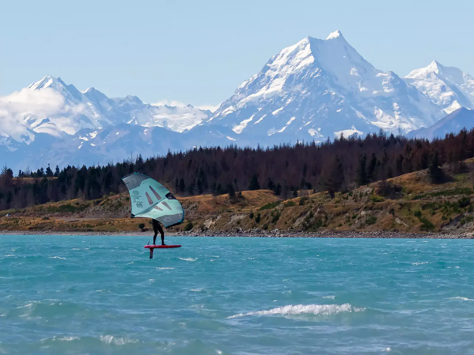
A trip to New Zealand’s South Island wouldn’t be complete without stopping and taking a picture of that famous vista: Milky blue water with the Southern Alps in the background.
Apart from a luxury lodge and a visitors center at the South end of the lake, there is no infrastructure (shops, restaurants,….) at Lake Pukaki. The road along the East side of the lake turns soon into a gravel road, State Highway 80 leads along the West side to Mount Cook.
Water Nomads Surfari group photo in front of Aoraki Mount Cook
Wind and water conditions:
Lake Pukaki is at 520m above sea level. It is fed on its northern end by the Tasman River, which has its source in the Tasman and Hooker Glaciers. This glacier water gives it its distinctive milky blue colour. The water temperature is around 18-20 degrees Celsius in the summer months.
With 30km of length from North to South, Lake Pukaki can build up some good sized waves at the South end in a strong Northerly wind.
Be aware, as on all the lakes in the Mackenzie Country, the weather can change super quick. We have seen the wind swing 180 degrees without missing a white cap!
We go to Lake Pukaki mainly on a Northwesterly forecast, though it pays to keep an eye on the wind meter at Mount Cook airport before getting too excited.
Big boulders - best to be avoided for easier access!
Rigging area and water access:
You can access the water right at the South end of the lake, but if the wind gets stronger, the shorebreak can be nasty.
For easier access, drive along the gravel road to the east side of the lake until you find a spot you like. There are plenty of opportunities, which are getting more scarce the further North you get. Be aware of cyclists as this road is also part of the Alps 2 Ocean cycle trail.
Rigging is on grass or gravel, access to the water is over some gravel. On some spots, there are huge boulders barring you entry to the water. Best avoid them by going a few hundred meters along the lake front. The entry can be a bit slippery but is usually not too bad.
As DOC cut most of the wilding pines down, there is hardly any shade along the lake. Take plenty of sun protection!
Crowdfactor:
You will be on your own on Lake Pukaki. If you want someone to keep an eye on you, get out on the South end where the tourists are or close to some of the camper vans that are parked up along the bottom end of Hayman Road.
Conclusion:
If you like traveling, exploring and windsurfing and / or winging off the beaten track, then Lake Pukaki is definitely a place to explore. But it pays to get to know the local weather pattern.
If you are by yourself, be aware that the weather can change super quickly. Keep an eye on what’s happening around you and – if you can – let someone know what you are up to.